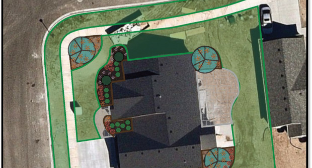
Landscape software design company LandOne is working with Nearmap to give users access to up-to-date, high-resolution aerial images. LandOne can work with drone photos, but the Nearmap integration allows users to simply search an address and instantly capture recent aerial views of a property.
Nearmap aerial imagery covers 700 urban and regional areas, including the cities and suburbs that house over 80 percent of the U.S. population — surveying more than 308,000 unique square miles each year.
LandOne founder, Joshua Martin, said, “This week I worked with a new user to design a new planting for a pool patio that had just been installed this spring. With one search we pulled a hi-res image that was less than a month old and already had the new patio in it. We immediately began designing the new planting right on the image.”